Last updated: 29 July 2023
Updated October 2022. A few years ago we visited Hurtgen Forest with Liberation Route Europe to follow in the footsteps of the brave men who fought and died whilst liberating Europe from Nazi Germany. When we first arrived in Hurtgenwald I was struck by the green scenery and how quaint the village was, little did I know just how much blood had been spilled on this beautiful landscape.
A Brief History
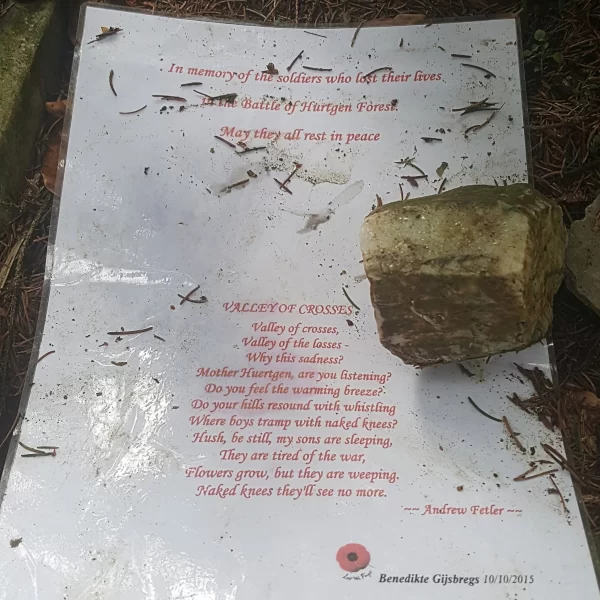
The Hurtgen Forest, located 50 square miles from the Belgian-German border, is recognised as the scene of a series of bloody battles in 1944-45. It was in the midst of this 32,000 acre forest that the Allied forces and German military waged war against each other, costing the lives of many ill-prepared young men who never stood a chance in what has been described as those who were there, as “the Death Factory”.
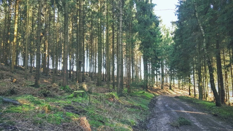
The Battle of Hurtgen Forest took place from 19 September 1944 to 10 February 1945 and holds the dubious honour of being the longest battle on German soil during World War II and the single longest battle that the American military has ever been engaged in.
For us the Hurtgen was one of the most costly, most unproductive, and most ill-advised battles that our army has ever fought.
General James Gavin, Commander, 82nd Airborne Division, 1944-45
Was Hurtgen Forest important?
From a German perspective, Hurtgen Forest was important for two main reasons; it was the staging area for the 1944 offensive operation Watch on the Rhine (aka The Battle of the Bulge) and the second, Hurtgen Forest controlled access to the Rur Dam.
From an Allied perspective, the primary goal was to prevent the German forces from reinforcing troops engaged in the Battle of Aachen and a later goal was to advance to the Rur River and seize control of the Rur dam (as part of Operation Queen). The most direct route to achieve this was through Hurtgen Forest, a decision which today has military historians arguing over its merit.
Westwall (Siegfried Line)
When visiting the Hurtgen Forest and learning about its history, you will encounter the term Westwall or Siegfried Line.
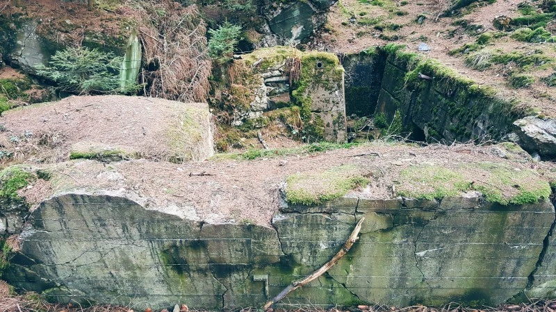
Westwall is a series of fortifications and defences built between 1938 and 1940, stretching more than 630 km (390 miles) and containing more than 18,000 bunkers, tunnels and tank traps. The types of defences used in the Westwall included pillboxes, Regalbau Bunkers, and “Dragon’s teeth” anti-tank defences.
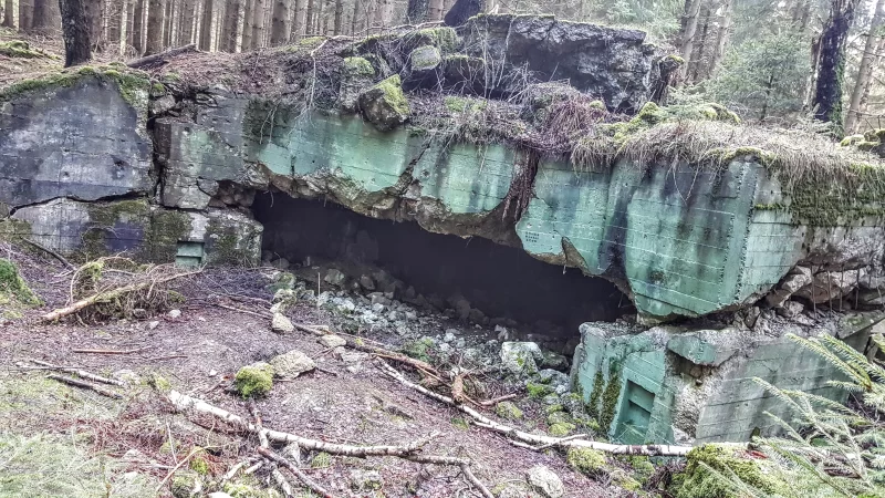
The original purpose of the Westwall was to protect the German western flank from possible French attacks however after France surrendered in 1940, the Westwall was abandoned. This led to the forest claiming the bunkers and other defences for itself.
It was in September 1944 that Adolph Hitler gave the below directive to commence renewed construction and reinforce the Westwall for the coming conflicts;
In the West, the fighting has advanced onto German soil along broad sectors. German cities and villages are becoming part of the combat zone. This fact must make us fight with fanatical determination and put up stiff resistance with every able-bodied man in the combat zone. Each pillbox, every city and village block must become a fortress against which the enemy will smash himself to bits or in which the German garrison will die in hand-to-hand fighting. There can be no large-scale operations on our part any longer. All we can do is hold our positions or die.
Visiting Hurtgen Forest Today
If you’re planning a visit to Hurtgen Forest or the surround areas then start with the Rureifel tourist board because it’s here that you can work out all the places that you can visit and maximise your holiday.
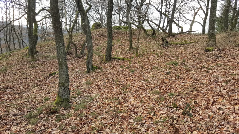
I mention this now because when visiting the Hurtgenwald, there are a selection of different hikes you can take which will take you on a journey through history so choosing the right hike is of the utmost importance.
We completed two trails during our visit, the Ochsenkopf Trail and Kall Trail. Our walk through the Hurtgen Forest and surrounding areas was led by our very knowledgeable guide, Hendrik, who expertly navigated us through the tricky terrain and gave us all a wonderful insight into the history of the area.
Ochsenkopf Trail
From the moment you first approach the Hurtgen Forest you find yourself slowing your pace and looking from side to side to absorb the sheer scale of landscape. I think that the one thing which surprised me the most was just how quiet the forest was, I could have heard a pin drop. This serenity belies its history that we could soon learn about it and bear witness to its modern day scars.
You could almost fool yourself into thinking that you were strolling through a serene countryside as part of a weekend getaway but all illusions were sharply shattered when you come across the first grave and memorial.
The large stone-covered grave and memorial belonging to an American soldier, Private First Class Robert Cahow, who was killed in action in December 1944.
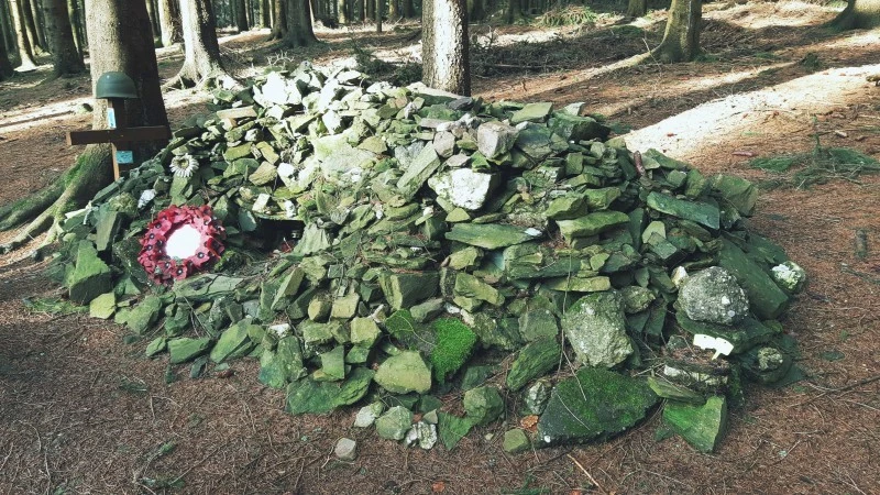
As you can tell, the grave site was really quite unique and represents the remarkable life and death of PFC Cahow. Robert Cahow, standing 6ft 7in tall, was drafted into World War II and held the position of MP, guarding POW’s in the US. The desire to serve his country in a more active capacity led to his enlistment and subsequent assignment to the 311th Infantry Regiment.
On December 13th 1944 PVC Cahow volunteered to rescue some wounded soldiers from site of a recent skirmish. During the rescue, Robert fatally triggered a booby trap, and the resulting explosion led to enemy fire.
Robert was missing and was soon listed as Missing in Action, and remained that way for the next 56 years. It was in the year 2000 that a German sweeping team working in Hurtgen Forest stumbled upon the graveside, owing to the fact that they detected 4 hand grenades alongside the remains of an American and two German soldiers. Whilst there wasn’t a conclusive ID on the American soldier, the size of the 6ft 7in frame and MIA record were sufficient to proclaim the remains as belonging to Private First Class Robert Cahow. A full memorial service was held to honour Robert Cahow.
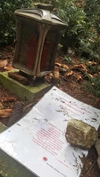
In 2001, the memorial in Hurtgen Forest was was constructed and made public for all to pay their respects. Today the grave site is covered with pebbles and rocks, a sign of respect from many cultures.
As we continued our journey through the forest, steadying ourselves as we navigated the steep hills, it wasn’t long until we found our first bunker. The bunkers which could be seen on the Ochsenkopf trail were part of the 18,000 created as part of the Westwall defence.
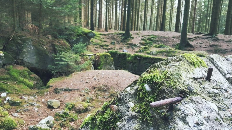
They were a sight to behold. It’s so eerie to stand there looking at a dilapidated pile of concrete with overgrown plants sprawled over every corner and knowing that over 70 years ago soldiers were fighting and dying to be standing in the place I was. Taking a moment to stand silently and let all of the history sink in became one of my most pivotal experiences I had during our journey with Liberation Route Europe.
As you walk through the forest surrounded by a vast array of tall trees, you look up. The trees were so close together that at some points it actually blocked out daylight and created an eerie and ominous atmosphere. It was here where we learned about tree bursts, a horrific technique where artillery shells were timed to explode overhead in the trees which caused hot shrapnel to rain down. This type of attack was particularly deadly to the American soldiers whom had been trained to drop to the ground for cover, this was quickly changed to a hug a tree technique.
The Kall Trail
The town of Schmidt, located at the southern end of the forest, was important to the Allied forces for a number of reasons. Some of them include;
- Schmidt was an important supply road for the German army on their way to the Siegfried line, near Monschau
- Control of Schmidt meant control of, and access to, the Rur dam
The decision to take the town of Schmidt, or at least attempt to, was one that the Allied forces would soon regret because descending through the deep Kall ravine to the river was far from easy and cost them much.
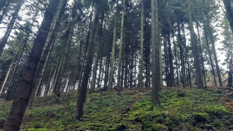
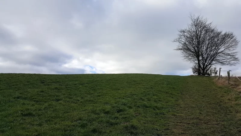
The opportunity to walk this trail and literally follow in the footsteps of the Allied forces was a definite highlight. The trail started out easy enough as you walked through open fields enjoying fresh air and enjoying the green fields but that soon changed when you commenced downwards through the valley. I was happy to have been wearing boots and a heavy duty jacket to ensure I didn’t trip over the winding path, trip over hidden tree roots, or encounter other random hazards ready to spring out at me… but the Allied forces were doing this with tanks!
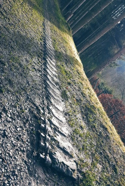
The very thought of a tank attempting to navigate the steep paths and rocky cliffs could almost be scoffed at but there is proof, original tank tracks left in the ground! Simply incredible. The best description I heard during this hike was from another guide that “there is no need for a museum building, this IS the museum”, gesturing the great outdoors. No arguments from us.
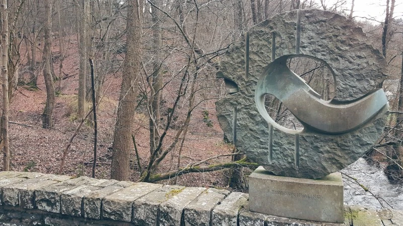
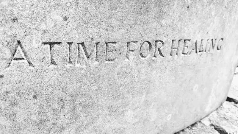
When we reached the river at the bottom of the valley, we were surrounded by natural beauty, all enhanced by the babbling river. In the middle of a small bridge crossing there is stone memorial sculpture, A Time for Healing, dedicated on the 60th anniversary of the ceasefire on Kall Bridge – November 7th 2004.
The sculpture was created by Michael Pohlman, who has stated;
I didn’t want to create a monument to heroes, no theatrical representation, no pathos, but wanted to appear more unassumingly with a frugal shape, hewn in stone, dignifying the actual place of the incident.
I would highly suggest taking the time to take the Kall Trail because not only will you be enjoying a sturdy outdoor hike, you will be connecting with a very important part of world history, and finally you will have the opportunity to walk in the footsteps of the Allied Forces.
Final Thoughts
The opportunity to travel with Liberation Route Europe through Belgium and Germany and visiting the historic World War II sites of Bastogne and Hürtgen Forest has been one of our travel highlights. We’ve both learned an incredible amount in such a short amount of time and it’s been an honour to share our travels with you all.
We encourage all our readers to learn more about the history of World War II, explore the personal stories available online, and visit these historic cities if given the opportunity.
A great way to learn more about Liberation Route Europe is through the app, available on Android and iOS, which provides some very detailed information, storylines, historical events, biographies and much more.
If you do decide to explore the historic Bastogne, Hurtgen Forest, and the surrounding areas to your travel list then make sure that you do check out the Rureifel Tourism website for plenty of itinerary suggestions to make the most out of your time in the area.
Disclaimer: Roaming Required partnered with Liberation Route Europe during our visits to Bastogne and Hurtgen Forest. We were not financially compensated and we retained editorial control over all content produced. As always, all opinions expressed remain our own.
Stumbled across your site and really enjoyed reading about the Hurtgen forest. My father fought in that battle and received a purple heart and bronze star after being injured. Would like to visit some time. Thanks for sharing.
Thank you so much for your kind comment, Donna. It really made my day that you found the post interesting. What a connection you have to Hurtgen Forest, honestly incredible.
This post left me with a very eerie feeling. Beautiful, powerful photographs. I am a HUUUUGE history buff. Thank you for sharing the website for Liberation Route Europe. I checked out their website and there are so many tours I want to go on after just 5 minutes of looking. Powerful stuff!
Thanks so much for the kind comment, Siggi. It really was an incredible experience visiting these battlefields in Europe and Liberation Route does a wonderful job ensuring that the memories of those who fought and died is never forgotten.